|

More Imaging Solutions
Imagemaps
brings together a suite of complementary products
to offer either point solutions for experienced
systems integrators, or complete survey / mapping
/ monitoring / surveillance solutions for service
providers. This offering is growing over
time as we form new relationships with leading
technology providers and with our extensive
experience, provide a bridge between customers,
designer and manufacturers to configure unique
best of class solutions.
|
|
|
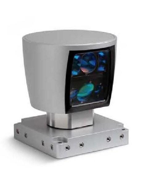
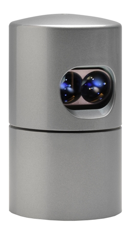
VELODYNE


Velodyne offers rugged, outdoor lidar
sensors for 3D data collection, autonomous
vehicle navigation and a range of other
mapping and real-time surveillance
applications.
Three sensors are available to cover extremely
capable, lightweight UAV mounted aerial
applications as well as land and marine
vehicles. The sensors use fixed array
lasers in a rotating head, eliminating
oscillating mirrors or rotating prisms which
enhances accuracy and reliability.
Both units are capable of incredible data
collection rates between 300,000 - 1,300,000
points per second at better than +-3cm accuracy.
Furthermore the fixed array arrangement in
an aerial configuration provides 100%
overlap along the flight line and look
angles from 10 degrees forward to 20 degrees
aft which provides data redundancy (lacking
in most lidar applications). This
arrangement permits an oblique view fore and
aft (for texturing building facades) and
virtually eliminates occlusions.
|
|
Download the Velodyne lidar specifications
here.
Quotation request.
|
|
GREENVALLEY INTERNATIONAL

GreenValley International is a turnkey provider in 3D mapping systems, post-processing software and GIS consultation. A one-stop geospatial solution for clients from forestry, ecology, energy infrastructure, BIM and more..
More info
Quotation request
|
|
|
APPLANIX
 The Applanix POS AV (Position and Orientation) System
integrates precision GPS (Global Positioning System) with
inertial technology to enable
geospatial
data collection projects as well as sensory data
surveys to be achieved with high accuracy, effectiveness, and
efficiency. The Applanix POS AV (Position and Orientation) System
integrates precision GPS (Global Positioning System) with
inertial technology to enable
geospatial
data collection projects as well as sensory data
surveys to be achieved with high accuracy, effectiveness, and
efficiency.
The POS AV is ideally suited and engineered
for aerial cameras, scanning lasers and lidar technology,
imaging sensors, synthetic aperture radars and other remote
sensors that need navigational and orientation to be processed
with the data collected.
The POS AV Allows for :
- Increased savings in operational costs
Limited ground control may be required only for
quality control check point purposes, eliminating the
need for a full ground survey
- Increased savings in time
The requirement for project wide tie-point
matching and aerotriangulation (AT) can be drastically
reduced or liminated completely, resulting in enormous
savings in data acquisition and processing time
More info
Quotation request
|