| |


 |
 |
|
 |
| |
|
|
| |
Visit us @
XXX INCA International Congress
10-12 November 2010, Dehradun, India
Survey of India Main Auditorium Lawns
Booth B2 |
|
| |
GEOSPATIAL WORLD FORUM
18-21 January 2011 Hyderabad , India
Hyderabad International
Convention Centre
Booth 14
Vexcel User Meeting
 |
|
 |
|
 |
|
|
|

Vexcel Extends Imagemap's Distribution Coverage  Top Top
October 2010 — Imagemaps Pte Ltd is pleased to announce that Vexcel Imaging GmbH, has extended Imagemap's distribution coverage to include India. Imagemaps was appointed exclusive distributor last September 2009 , responsible for the People's Republic of China, Taiwan, Australia, New Zealand and ASEAN (Singapore, Malaysia, Indonesia, Brunei, Thailand, Philippines, Vietnam, Laos, Cambodia and Myanmar).
Over the past year, Imagemaps have successfully sold and serviced several Vexcel cameras in the region. Vexcel have recognised Imagemap's expanding sales and service networks and also Imagemap's contribution over the year as a dedicated Vexcel distributor.
With the appointment of Imagemaps to cover India,Imagemaps hope to further expand its growing presence and clientele base for Vexcel products. Imagemaps will provide value added solutions to promote aerial sensing systems and will promote them through our reseller network in the region.
Imagemaps Pte Ltd's Managing Director, Mr. Bill Love said " There is a huge potential for the use of Vexcel's Aerial sensing camera in India. We are very enthusiastic about this new challenge and will be putting in alot of resources to increase Vexcel's market share in India."
Currently, Imagemaps have already begun marketing activities in India which includes participation in major events like the upcoming INCA International Congress 10-12 November 2010 , 2010- Dehradun, India and Geospatial World Forum 18-21 January 2011 Hyderabad , India.
###
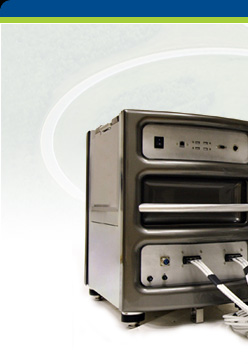
About Vexcel Imaging, GmbH
Acquired by Microsoft Corporation in May 2006, Vexcel
Imaging GmbH brings more than two decades of
photogrammetry expertise to Microsoft’s Bing Maps business unit and is at the heart of the
burgeoning Microsoft photogrammetry business. The
company’s offerings include its series of UltraCam
large- and medium-format digital aerial mapping cameras
and related software tools such as the UltraMap 2.1 workflow software.
Microsoft’s
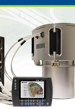
Vexcel Imaging GmbH Announces Release of UltraMap 2.1
and UltraMap/AT Top
Graz, Austria — Vexcel Imaging GmbH, a Microsoft® company, will roll out version 2.1 of its UltraMap 2.1 and UltraMap/AT photogrammetric
software to customers beginning July 19, 2010. These
releases continue the tradition of providing a flexible
and scalable distributed system for managing and
processing vast amounts of UltraCam data.
UltraMap 2.1 and UltraMap/AT 2.1 include many new capabilities to
enable customers to process projects even faster and
better than previously possible, and with a higher level
of automation. Project-based color balancing, 1-click
system reports, and level-2 quality visualization are
examples of key new capabilities in UltraMap 2.1.
Other key new major features of UltraMap 2.1 include:
- Framework now offers “One-click” system report
generation for any local UltraMap node and the
complete UltraMap system.
- Raw Data Center now offers the option to format a data
unit; the option to check unverified raw data on a
data unit; generation of Level-2 quality information
for each image to be visualized by the UltraMap
Viewer; and generation of a Level-2 quality xml file
for each image.
- Radiometry now offers automated quick view
generation; fully integrated project-based color
balancing based on automatically extracted
parameters during AT; clipping visualization; and
the option to specify the output range (min/max).
- Viewer now offers Level-2 quality visualization;
text overlays for shot position; and a new viewer
with DFI stand-alone support.
UltraMap/AT 2.1 now offers text overlays for ground
control points; vector residual overlays; tie point
merger; automated blunder removal during bundle
adjustment; a detailed AT report; integrated data
extraction for project-based color balancing; and PAT-B
bundle result export.
UltraMap includes features for managing data download,
distributed processing using load balancing and resource
management, aerial triangulation, and interactive data
visualization for quality control. Use of Microsoft’s
Dragonfly technology enables incredibly smooth and
high-resolution image browsing and zooming for very
large sets of data content. Dragonfly supports
multi-channel 16-bit UltraCam imagery for high quality
visualization within the complete photogrammetric
workflow.
“I am proud of the accomplishment this product release
represents for the Vexcel Imaging team,” notes Alexander
Wiechert, Business Director of Microsoft and Managing
Director for Vexcel Imaging GmbH. “It supports our
customers’ businesses by enabling easier, faster image
processing and more automation than ever before.”
###
About Vexcel Imaging, GmbH
Acquired by Microsoft Corporation in May 2006, Vexcel
Imaging GmbH brings more than two decades of
photogrammetry expertise to Microsoft’s Bing Maps business unit and is at the heart of the
burgeoning Microsoft photogrammetry business. The
company’s offerings include its series of UltraCam
large- and medium-format digital aerial mapping cameras
and related software tools such as the UltraMap 2.1 workflow software.
|
|
| |
|
| |
IMAGEMAPS
ESTABLISHES CHINA OFFICE Top
For
Immediate Release: Beijing, 26 Mar 2010 —Imagemaps announces the establishment of Imagemaps
(China) Representative Office situated at Room 1707,
Block F, Wanda Plaza, Shijingshan District, Beijing,
China 100034. The new office will provide product sales
and support for Microsoft Vexcel’s Ultracam digital
aerial cameras and photogrammetric software. The first
order of business for Imagemaps China is training for
its newly appointed reseller, Beijing Siwei Spatial
Data Technology Co. Ltd , which will take place this
month. Imagemaps appointed Beijing Siwei last December.
The new reseller network replaces Vexcel Spatial Information
Technical Company (trading as “Vexcel China”)
which has represented Vexcel camera sales until late
last year. The former reseller has a successful record
of Vexcel photo-scanner and recent camera sales but
is changing its company focus to exclude the demanding
aerial camera business.
Imagemaps together with it’s principal, Microsoft
Vexcel Imaging, is also pleased to announce the Microsoft
Vexcel Conference 2010 scheduled for March in China.
This will be the inaugural meeting of Ultracam digital
aerial camera users and will take place at the Crown
Plaza Parkview Wuzhou Beijing venue. Key note speakers
will include Prof Li Deren from Wuhan University, Alexander
Wiechert (Managing Director, Microsoft Vexcel Imaging),
Abhineet Jain (Product Marketing Manager, Imagemaps)
and leading aerial service providers in the People’s
Republic of China region.
With a strong partner and newly established Imagemaps
Representative office in Beijing, Imagemaps will be
organising many new marketing and sales initiatives
in 2010 for its customers.
###
About Imagemaps Pte. Ltd.
Imagemaps Pte Ltd is a leading sensor solutions provider
in APAC with extensive experience in aerial sensing technologies
and geospatial solutions. Its airborne sensor solutions
include digital mapping cameras, lidar systems, inertial
measurement and positional systems, digital photogrammetry
and imaging technology, lidar data processing and workflow
management of large multimedia spatial databases. Imagemaps
is Vexcel Imaging's sales representative responsible for
the People's Republic of China, Taiwan, Australia, New
Zealand and ASEAN (Singapore, Malaysia, Indonesia, Brunei,
Thailand, Philippines, Vietnam, Laos, Cambodia and Myanmar).
For enquries, please call +65 67731281 or email to info@imagemaps.com. For more
information , please go to www.imagemaps.com.
|
|
| |
IMAGEMAPS
SELLS ULTRACAMXP TO STRONG ENGINEERING CONSULTING CO.,
LTD, TAIWAN Top
For
Immediate Release 19 Mar 2010 —Imagemaps Pte Ltd is pleased to announce that
it has closed a deal with Strong Engineering Consulting
Co., Ltd, Taiwan for the purchase of a UltraCamXp large
format digital aerial camera system.
The Microsoft UltraCamXp reduces the number of flight
lines saves time, and lowers cost, without sacrificing
radiometric performance. The UltracamXp is capable of
collecting stereo imagery at a remarkable 1 inch GSD
at a flight speed of 110 knots. Post-processing of the
data can be started on board, and finished on the ground
with a group of PCs for even faster turnaround. As major
projects are completed in an impressively short period
of time, in relation to the number of pixels collected,
this guarantees a highly efficient project execution
and completion certainty
"With the purchase of the UltraCamXp system
we will be able to provide large area coverage high
radiometric and geometric quality for our customers"
said Cheng-Piao Lia, President of Strong Engineering
Consulting Co., Ltd. " We will use the UltraCamXp
to provide better service to our existing customers
from private companies, corporate organizations and
civil industries in area of surveying, designing and
other business operations.
"Strong being one of the major aerial mapping
service providers in Taiwan, went through a careful
selection process to select best price-performance aerial
product from all available large format cameras in the
world. Their final decision indicates that Microsoft
Vexcel mapping solutions is now the mainstream market
in the region." said Lee Sze Keong, General Manager
of Imagemaps Pte Ltd."
###
About Imagemaps Pte. Ltd.
Imagemaps Pte Ltd is a leading sensor solutions provider
in APAC with extensive experience in aerial sensing technologies
and geospatial solutions. Its airborne sensor solutions
include digital mapping cameras, lidar systems, inertial
measurement and positional systems, digital photogrammetry
and imaging technology, lidar data processing and workflow
management of large multimedia spatial databases. Imagemaps
is Vexcel Imaging's sales representative responsible for
the People's Republic of China, Taiwan, Australia, New
Zealand and ASEAN (Singapore, Malaysia, Indonesia, Brunei,
Thailand, Philippines, Vietnam, Laos, Cambodia and Myanmar).
For enquries, please call +65 67731281 or email to info@imagemaps.com. For more
information , please go to www.imagemaps.com.
About Strong Engineering Consulting Co., Ltd
Strong Engineering Consulting Co., Ltd was established
in 1984. In the past 22 years, we have handled surveying
jobs from private companies, corporate organizations
and civil industries in works of surveying, designing
and other business operations. From traditional geographical
surveying, and designing to various types of professional
teams in construction planning, testing system designs,
GIS system development, professional ocean surveying
and analysis.For enquiries , please call +02-22252200
or email to strongco@strongco.com.tw.
For more information , please go to www.
strongco.com.tw.
|
|
| |
IMAGEMAPS
EXPANDS RESELLER NETWORK IN ASIA Top
For
Immediate Release 23 Feb 2010—Imagemaps Pte. Ltd., Vexcel Imaging’s
sales partner responsible for the People’s Republic
of China Taiwan, Australia, New Zealand and ASEAN, has
appointed Royal Sky Co., Ltd. and Borsar Sdn. Bhd. as
its resellers for Microsoft Vexcel photogrammetric products
in the Thailand and State of Sarawak (East Malaysia)
markets respectively.
"The appointment of both Royal Sky and Borsar is
part of our aim to achieve better market coverage, increase
product market share and provide better customer care
services for our customers. " said Lee Sze Keong, General
Manager, Imagemaps Pte Ltd. "Royal Sky's strength is
in its aviation related business dealings with Thai
Military and Government customers and this makes them
a perfect choice to represent us to promote Microsoft
Vexcel products in Thailand. Borsar, a previous Vexcel
products partner, has a very good track record of successful
sales of Ultracam to Sarawak Land and Survey Dept. We
would like Borsar to continue its success story by working
closely with other potential clients in natural resources,
Forestry, infrastructure etc in State of Sarawak."
The expansion of Imagemap's reseller network will
help to meet the demand of the Asian market for premuim
aerial mapping products and extend the availability
of Vexcel Imaging’s aerial mapping products that
include the UltraCamXp and UltraCamXp
Wide Angle large format digital aerial sensors,
the UltraCamLp medium format sensor and the UltraMap
2.0 digital workflow software system.
###
About Imagemaps Pte. Ltd.
Imagemaps Pte Ltd is a leading sensor solutions provider
in APAC with extensive experience in ariel sensing technologies
and geospatial solutions. Its airborne sensor solutions
include digital mapping cameras, lidar systems, inertial
measurement and positional systems, digital photogrammetry
and imaging technology, lidar data processing and workflow
management of large multimedia spatial databases. Imagemaps
is Vexcel Imaging’s sales representative responsible
for the People’s Republic of China, Taiwan, Australia,
New Zealand and ASEAN (Singapore, Malaysia, Indonesia,
Brunei, Thailand, Philippines, Vietnam, Laos, Cambodia
and Myanmar). For enquries, please call +65 67731281 or
email to info@imagemaps.com. For more
information , please go to www.imagemaps.com.
About Vexcel Imaging, GmbH
Acquired by Microsoft Corporation in May 2006, Vexcel
Imaging GmbH brings 20 years of photogrammetry expertise
to Microsoft's Bing Maps business unit
and is at the heart of the burgeoning Microsoft Photogrammetry
business. The company's offerings include its series
of UltraCam digital aerial mapping cameras and related
software tools such as the UltraMap 2.0 workflow software.
|
|
| |
IMAGEMAPS
APPOINTS FIRST RESELLER IN CHINA Top
For
Immediate Release 20 Jan 2010—Imagemaps Pte Ltd is pleased to announce that
it has appointed Beijing Siwei Spatial Data Technology
Co., Ltd as its first reseller for Vexcel Ultracam
products in the China market.
Beijing Siwei
is a subsidiary of the Chinese Academy of Surveying
and Mapping under the State Bureau of Surveying and
Mapping. Beijing Siwei undertakes many major aerial
and mapping projects for the Chinese government. With
its good connections and relationships with all major
aerial survey companies in China, Beijing Siwei is an
ideal partner complementing Imagemaps in the territory.
"The appointment
of Beijing Siwei Spatial Data Technology Co., Ltd is a start of our aim to achieve better market coverage,
increase product market share and provide better customer
care services for our customers." said Lee Sze
Keong, General Manager, Imagemaps Pte Ltd. "Beijing
Siwei is an ideal partner given its experience in the
field and its sales and technical support capabilities.
We are pleased to have a strong partner like Beijing
Siwei and will be organising many exciting marketing
and sales activities in 2010 for our customers."
###
About Beijing Siwei
Beijing Siwei Spatial Data Technology Co., Ltd. (北京四维空间数码科技有限公司)(Beijing
Siwei) is a subsidiary of the Chinese Academy of Surveying
and Mapping (中国测绘科学研究院)
directly under STATE BUREAU OF SURVEYING & MAPPING.
Beijing Siwei was founded in year 2001 and its core
business is remote sensing engineering, geospatial data
processing and geospatial solutions & system integrations
and developments. The company employs more than 100
staff and has a subsidiary in Inner Mongolia which specializes
in providing professional services in Geospatial projects.
Beijing Siwei was awarded with National Mapping Grade
A Certification by the Chinese Government and is GJB9001A-2001
and ISO 9001 certified.
About Imagemaps Pte. Ltd.
Imagemaps Pte Ltd is a leading sensor solutions provider
in APAC with extensive experience in ariel sensing technologies
and geospatial solutions. Its airborne sensor solutions
include digital mapping cameras, lidar systems, inertial
measurement and positional systems, digital photogrammetry
and imaging technology, lidar data processing and workflow
management of large multimedia spatial databases. Imagemaps
is Vexcel Imaging’s sales representative responsible
for the People’s Republic of China, Taiwan, Australia,
New Zealand and ASEAN (Singapore, Malaysia, Indonesia,
Brunei, Thailand, Philippines, Vietnam, Laos, Cambodia
and Myanmar). For enquries, please call +65 67731281 or
email to info@imagemaps.com. For more
information , please go to www.imagemaps.com.
About Vexcel Imaging, GmbH
Acquired by Microsoft Corporation in May 2006, Vexcel
Imaging GmbH brings 20 years of photogrammetry expertise
to Microsoft's Bing Maps business unit
and is at the heart of the burgeoning Microsoft Photogrammetry
business. The company's offerings include its series
of UltraCam digital aerial mapping cameras and related
software tools such as the UltraMap 2.0 workflow software.
|
|
| |
Imagemaps Sells
First UltraCamXp Wide Angle Sensor to GeoForce Technologies Top
For
Immediate Release 5 Jan 2010 — Imagemaps Pte Ltd is pleased to announce that
the company has signed a purchase agreement with GeoForce
Technologies Co., Ltd. of Taiwan to upgrade an UltraCamD
to an UltraCamXp Wide Angle large format digital aerial camera system.
"This is
the first unit of the newest UltraCam sold.” said
Lee Sze Keong, director of Imagemaps Pte Ltd."GeoForce
Technologies will use the UltraCamXp Wide Angle to serve
its existing customers, including agencies , the central
government, academic and research institutions, and
the telecommunications industry."
"This upgrade
to the UltraCamXp Wide Angle was an easy decision for
us," said Robert Hsu, President of GeoForce Technologies.
"We appreciate the UltraCam heritage, and the UltraCamXp
Wide Angle has the right combination of large area coverage
and high radiometric and geometric quality for our customers.
We are also confident of Imagemaps Pte Ltd expertise
and support for this project ."
"We are
pleased that GeoForce Technologies is continuing its
legacy as an innovative company by selecting the UltraCamXp
Wide Angle to support its projects," said Alexander
Wiechert, Business Director of Microsoft and Managing
Director for Vexcel Imaging GmbH.
The new Microsoft
UltraCamXp Wide Angle large format digital aerial camera
takes advantage of the same innovative camera concept
and image quality as the UltraCamXp but features a new proprietary, digital, high-performance,
high-resolution lens system with a shorter focal length.
This allows the latest UltraCam sensor to deliver the
same ground sample distance (GSD) as the UltraCamXp,
but at lower flight altitudes. An alternative to the
UltraCamXp and at the same price, the UltraCamXp Wide
Angle provides small-scale mapping capabilities to customers
with lower-flying airplanes. The UltraCamXp Wide Angle
provides the same large image format as the UltraCamXp
at 196 megapixels (17,310 across track x 11,310 along
track), and a pixel size at 6 ?m. It integrates fully
with existing UltraCamXp and UltraCamX storage and computing
systems and is fully supported by Vexcel Imaging’s
UltraMap 2.0 workflow software system.
###
About GeoForce Technologies
GeoForce Technologies Co., Ltd., is a leading provider
of high-resolution image solutions in Taiwan. Headquartered
in Taipei, with branch offices throughout the country,
GeoForce Technologies is the first company in Taiwan
to own an aerial digital camera. GeoForce delivers a
complete range of aerial photo products and hardware
/ software solutions along with industry-leading professional
services and support. For more information please go
to www.geoforce.com.tw.
About Imagemaps Pte. Ltd.
Imagemaps Pte Ltd is a leading sensor solutions provider
in APAC with extensive experience in ariel sensing technologies
and geospatial solutions. Its airborne sensor solutions
include digital mapping cameras, lidar systems, inertial
measurement and positional systems, digital photogrammetry
and imaging technology, lidar data processing and workflow
management of large multimedia spatial databases. Imagemaps
is Vexcel Imaging’s sales representative responsible
for the People’s Republic of China, Taiwan, Australia,
New Zealand and ASEAN (Singapore, Malaysia, Indonesia,
Brunei, Thailand, Philippines, Vietnam, Laos, Cambodia
and Myanmar). For enquries, please call +65 67731281 or
email to info@imagemaps.com. For more
information , please go to www.imagemaps.com.
About Vexcel Imaging, GmbH
Acquired by Microsoft Corporation in May 2006, Vexcel
Imaging GmbH brings 20 years of photogrammetry expertise
to Microsoft's Bing Maps business unit
and is at the heart of the burgeoning Microsoft Photogrammetry
business. The company's offerings include its series
of UltraCam digital aerial mapping cameras and related
software tools such as the UltraMap 2.0 workflow software.
|
|
| |
Microsoft’s
Vexcel Imaging GmbH Releases the UltraCamXp Wide Angle Top
Graz,
Austria — Vexcel Imaging GmbH announces the release of the UltraCamXp Wide Angle, a new version of the UltraCam large format
digital aerial camera system that features a wide-angle
lens with a shorter focal length. The UltraCamXp Wide
Angle allows lower-flying airplanes to collect data
at the same ground sample distance (GSD) as higher-flying
planes carrying the UltraCamXp, while delivering comparable
image quality.
The large image
format of the UltraCamXp Wide Angle is identical to
that of the UltraCamXp at 196 megapixels, or 17,310 across track and 11,310
along track panchromatic pixels. The pixel size is 6
µm, and geometric accuracy is better than +/-
2 µm. Post-processing can be started on board
and completed on the ground with a laptop or group of
PC’s for faster turnaround. The new Wide Angle
model also is fully compatible with the storage (DXp)
and computing (CXp) systems of the UltraCamX and UltraCamXp,
and is fully supported by Vexcel’s UltraMap workflow
software system, so existing customers can add an UltraCamXp
Wide Angle to their resources without purchasing additional
hardware and software. UltraCamD and UltraCamX customers
are eligible for upgrade to the UltraCamXp Wide Angle
via trade-ins.
The UltraCamXp
Wide Angle digital camera is capable of collecting stereo
imagery at a 1-inch GSD at a flight speed of 110 knots,
a remarkable technical achievement. Photogrammetric
and remote sensing applications for imagery collected
by the UltraCamXp Wide Angle include large-scale engineering
mapping, high-resolution orthophoto production, multi-ray
photogrammetry, feature extraction and classification.
"The UltraCamXp
Wide Angle offers customers with lower-flying planes
exceptional small-scale mapping capabilities,”
explained Alexander Wiechert, Business Director of Microsoft
and Managing Director for Vexcel Imaging GmbH. “A
combination of the largest PAN footprint available and
the ability to collect data at a rate of 2.5 Gbits per
second means mapping projects can be completed in less
time at lower costs."
|
|
|
|