| |
|

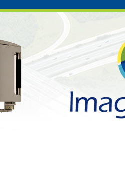
Premier imaging and laser scanning
system for corridor and project mapping.
|
 |
|
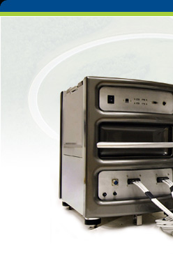
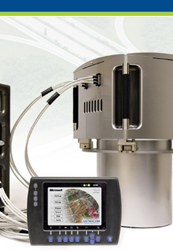
Trimble
Harrier 56
|
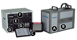
- Trimble Aerial Camera
provides metric, medium format imagery.
- Rotating polygon airborne
laser scanner ensures high accuracy and reliability.
Limited moving parts in the laser scanner and
a rigid chassis design means you have to perform
equipment calibration only once per year.
- Easy-to-use operator
and pilot displays provide real-time monitoring
of system status, imagery, and ground coverage.
- Power supply with UPS
provides the system with clean, uninterrupted
power even through aircraft power glitches.
- Control computer integrates
and controls all subsystems.
- Applanix POSTrack provide
GNSS-aided inertial direct georeferencing and
advanced Flight Management System
- Data recording units
are sized for the vast amounts of imagery and
laser scanning data generated by a truly productive
system.
|
The Trimble Harrier Corridor Mapping
Systems set a new standard for digital image acquisition
and laser scanning. Designed for both aircraft and helicopter
operation, the Trimble Harrier 56 is ideal for corridor
mapping, project mapping, and remote sensing.
Incorporating a wide-angle, full-waveform digitization
airborne laser scanner, the Trimble Harrier 56 enables
you to extract the most comprehensive information. The
laser scanner's 120,000- to 160,000-Hz measurement rate
delivers high point density on the ground to provide
the detailed modeling data needed for precise planning,
engineering, and monitoring applications.
|
|