| |
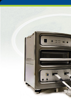
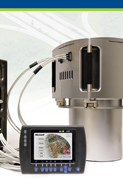
Our aerial
data capture and data processing solutions enable
you to deliver geospatial data more quickly than
ever before, ultimately saving time and cutting
project costs. They help you:
- Capture high-resolution data with confidence
in its precision and accuracy.
- Increase the productivity of your aircraft
and reduce environmental impact by flying sharp
turns over long baselines.
- Reduce the need for control points using direct
georeferencing and advanced aerial triangulation
software.
- Increase the efficiency of your data processing
operation through streamlined workflows and
high levels of automation – while also reducing
training costs.
- Grow your business into new applications –
to capitalize on new market opportunities, diversify
revenue streams, extend the flying season and
increase equipment utilization.
Whether you need a single subsystem
like GNSS+Inertial georeferencing or you are looking
to invest in a complete turnkey mapping solution,
our broad product line will address your need
and help keep you productive and competitive today
and in the future.
|
|