Main Product and Services News and Events Contact Us Resellers  


TopoSys Lidar Solutions

Toposys write-ups....


Harrier 56/G4 sets a new edge on both – digital image acquisition and LIDAR scanning. The combination of the wide angle full wave form digitization Laser scanner Riegl LMS-Q560 and a medium-format digital frame camera makes this system the perfect tool for corridor mapping, aerial survey and remote sensing whenever your customer asks you to deliver the real details. more


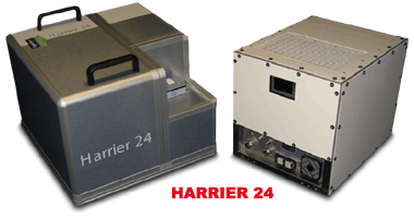
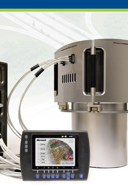
The Harrier 24 is the ready to use low cost LIDAR system that allows you to easily and successfully add LIDAR Scanning to your existing business.

But you can get more: the Harrier 24 is also the digital imaging answer for aerial survey and remote sensing. Having additionally a wide angle Laser scanner integrated, the Harrier 24 allows you also to expand your business just by switching on the Laser. more


The TopPIT (TopoSys Processing and Imaging Tools) software package is a development of TopoSys GmbH for the analysis and reprocessing of LIDAR and RGB/NIR data. The software is optimised for the analysis of TopoSys Falcon data. Due to the modular structure of the software and the integrated import interfaces, data of other sensor manufacturers can also be processed efficiently.
Export interfaces enable reprocessing of data with all conventional GIS and image processing programs. more


Copyright© Imagemaps Pte Ltd. 2009. All rights reserved.